“World Wind lets you zoom from satellite altitude into any place on Earth. Leveraging Landsat satellite imagery and Shuttle Radar Topography Mission data, World Wind lets you experience Earth terrain in visually rich 3D, just as if you were really there.”… and it’s open source!
World Wind comes with data you can zoom into. After a certain point, World Wind will begin to download more images automatically. The servers hosting this information are very busy and may be unresponsive until we get the necessary infrastructure.
NASA World Wind leverages Microsoft .NET technology for rapid development and to easily access open standards such as XML, WMS, and other graphics standards. Real-time 3D graphics are driven by DirectX allowing a wide base of compatibility with accelerated video hardware.
World Wind is developed at NASA Ames Research Center by Chris Maxwell, Randy Kim, Tom Gaskins, Bruce Lam and project manager Patrick Hogan.
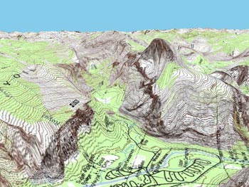
Screenshots from the site:
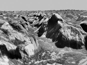

More impressive screenshots
Visit the NASA World Wind Site
Download World Wind 1.3.3.1
via Digg.
More reviews on World Wind:
From Gary Price over at Resource Shelf, almost a year ago (!)
Also at SearchEngineWatch (Thanks for the tip, Gary!)
Gary, currently and since recently working for Ask.com also pointed me to
World Wind’s 3D imagery from the Moon.